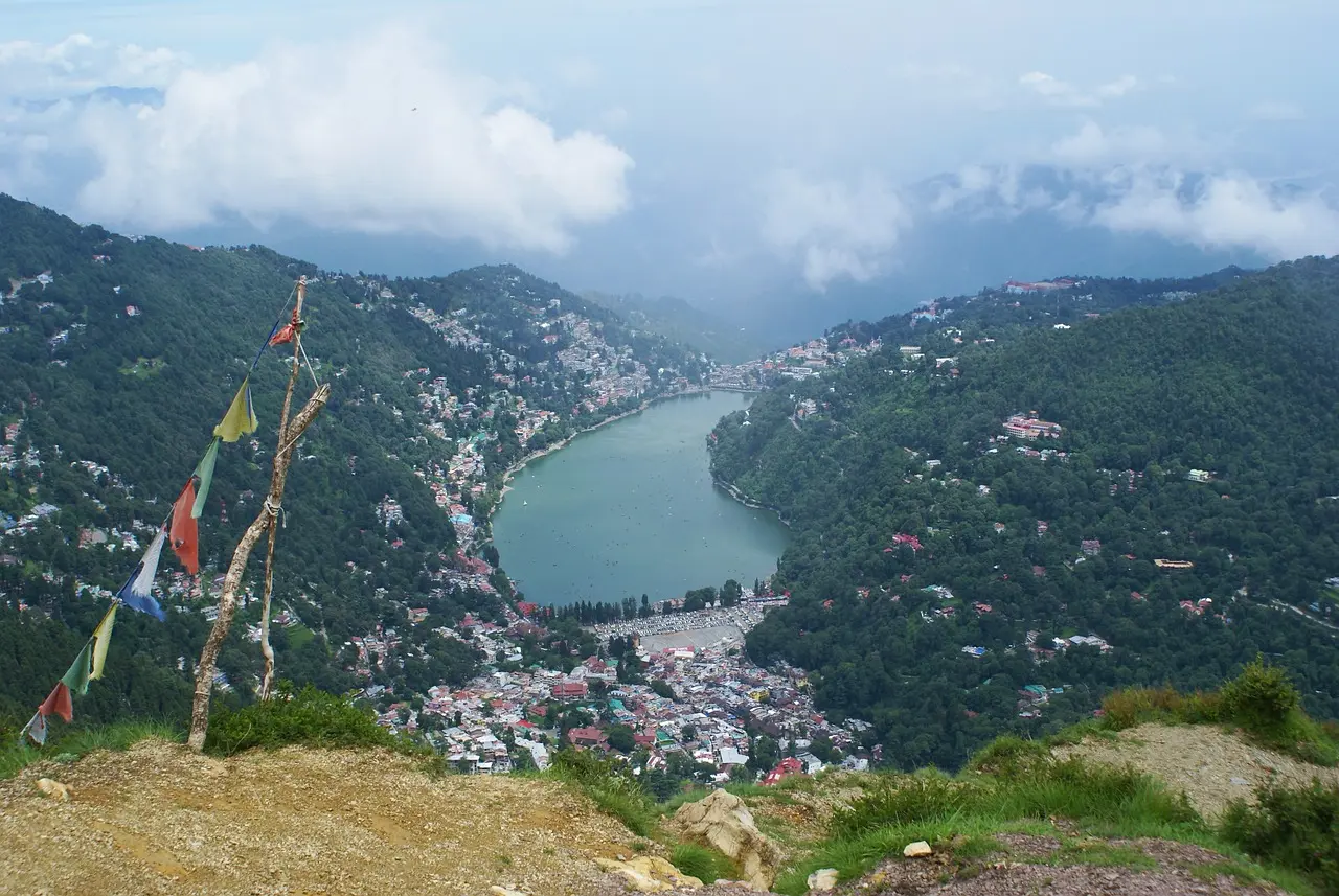
Standing at an elevation of approximately 2,615 meters above sea level, Naini Peak—widely known as Naina Peak and historically referred to as China Peak or Cheena Peak—is the highest summit crowning the hills surrounding Nainital. Located in the Kumaon region of Uttarakhand, India, this high mountain point dominates the northern side of the crescent-shaped valley in which the town is situated. For generations, the peak has served as an essential geographical landmark for the hill station, defining the high boundary between the urbanized lake basin and the rugged, forested terrain stretching northward toward the higher Himalayan ranges. Its prominent silhouette is visible from almost anywhere within the lower settlement, forming a permanent backdrop against the skyline. The naming of the peak reflects a blend of regional history, folklore, and spiritual tradition. During the colonial era and into the mid-twentieth century, the high point was known locally and officially as China Peak. Local folklore long held that from its summit, observers could look across successive mountain ridges toward the remote Tibetan borderlands, leading early residents to associate the spot with the far northern frontier. In more recent decades, the summit was officially renamed Naina Peak to connect the mountain directly with Naina Devi, the patron deity of Nainital whose historic temple rests along the northern shore of the lake below. This designation aligns the peak with the spiritual identity of the Kumaon region while preserving its historical legacy. Reaching the top of Naini Peak is one of the most rewarding outdoor activities for visitors to Nainital, attracting casual day-hikers and trekking enthusiasts alike. The trail begins near the edge of the town, gradually leaving the populated streets behind as it ascends through dense forest. The forest along the path is rich with native vegetation, dominated by tall deodar cedars, Himalayan oak, and wild rhododendron trees. In the spring, the rhododendrons bloom in shades of crimson and red, coloring the green forest floor and upper canopy. The air grows cool and crisp with every gain in altitude, filled with the scent of pine and crushed leaves carried on the mountain breeze. Upon reaching the summit ridge, hikers encounter a sweeping panorama that covers both the town below and the surrounding mountain environment. Looking down to the south, the entirety of Nainital unfolds in detailed perspective. The eye-shaped expanse of Naini Lake glimmers in the valley floor, framed by hillside houses, winding roads, and the lower green ridges surrounding the basin. From this vantage point, the relationship between the town and its natural mountain setting becomes clear, showing how urban development settled into the contours of the hill station while remaining encircled by steep, forested slopes. Turning toward the north and northeast, the view from Naini Peak shifts to the distant wall of the Greater Himalayas. On clear days, particularly during the crisp autumn and winter months when atmospheric visibility is highest, the horizon reveals a long chain of snow-capped peaks rising above the Kumaon ridges. The white snowfields provide a stark visual contrast to the deep green oak and pine forests in the foreground. This rare combination—a top-down view of an active lake town on one side and an open gaze toward the remote Himalayan peaks on the other—makes the summit a premier viewpoint in the state. In addition to its visual beauty, Naini Peak plays an important role in maintaining the ecological balance of the Nainital watershed. The dense foliage covering its high slopes acts as a natural catchment zone for monsoon rainfall, absorbing surface runoff and feeding the underground springs that supply water to Naini Lake. The thick root systems of the oak and deodar trees stabilize the steep slopes, helping prevent soil erosion and landslides that could threaten the lower town. The forested environment also shelters local wildlife, providing habitat for mountain birds, small mammals, and native plant species unique to high-altitude Kumaon forests. Throughout its history, Naini Peak has offered quiet sanctuary for those looking to escape the bustle of daily life. During the nineteenth century, early visitors constructed simple walking trails up the mountain to enjoy cool mountain air and outdoor picnics. Today, the peak remains a favorite spot for local residents taking morning walks, as well as travelers seeking a day hike that does not require deep wilderness travel. The summit area offers a peaceful resting place where visitors can take in the fresh air, observe changing light across the valleys, and watch clouds drift across the high ridges. The trek to Naini Peak typically spans a distance of roughly six to seven kilometers from the town center, following a continuous incline through the forested hillside. For visitors unable to complete the entire walk on foot, horses and ponies are available along parts of the route. Planning the trip during early morning hours yields the best experience, as early daylight provides optimal clarity for viewing both the town lake and the high Himalayan range before afternoon haze develops. As Nainital grows as a tourist center, Naini Peak endures as an unblemished natural highlight, showcasing the rugged high-altitude landscapes of Uttarakhand.
No FAQs available for this item. If you have any questions, please feel free to contact us.